Friday, June 30, 2023

FlightSimExpo 2023 Houston

Back from Houston and mostly recovered from jet lag, here is a recap of the fruitful and enriching GeoFS participation to FSExpo 2023.

I started to believe this would be a crazy week-end when I was idly looking through the window of the KLM A330 that was bringing me to HIA, somewhere between Arkansas and Tennessee, and I spotted what I first thought was an eagle, just to realize that those do not fly at FL370 and to finally accept that, yes, it was one of the twenty existing Northrop Grumman B-2 Spirit Stealth Bomber that just crossed our path a few thousand feet below us. By the time I took my phone, I could only take this distant picture of it. Funnily, when I later asked the pilots if they saw the bomber, they just said "nope". I guess these things do not trigger TCAS alerts nor carry ADS-B transponders.

A short 22 hours trip door to door later, I could share a beer with a 737 pilot from Southwest at my hotel's bar before taking some sleep for the first time in about a day and a half and getting ready for next day's work.

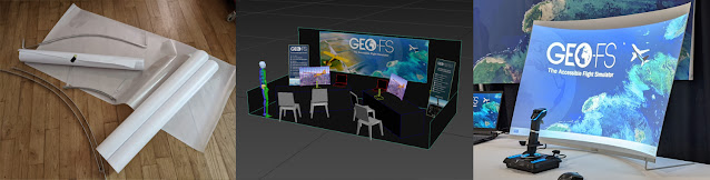
For the second attendance to the event, GeoFS had a double booth that gave loads of space to setup two demo stations. The problem is to get the whole booth setup from Europe to the US. I know I could ship some of it but I like the idea (and do a lot of jokes about it) to fit my whole booth within my 23kg checked-in luggage. (OK, the laptops are in the backpack)

before / after

I usually rely on projectors for their compacity but the foldable screens are always crumpled on arrival. Also, small projectors and big screens end up being too dimmed for the bright exhibition halls.

So, this year, after months of searching for the right materials, 5 prototypes and a 3D modelisation to preview the result, I came up with a novel idea to have two big 45 inch rear projection screens that I could roll up and fit in the suitcase.

from prototypes to exhibition booth

The Friday was spent putting the booth together where I was relieved to see that these projected displays worked out really well. So well in fact that they created a new problem: everybody stopped to ask about the screens and forgot that I was there for the software.

So after having explained the conception of these to literally every single visitor, I could tell them more about GeoFS. They came for the screen, they stayed for the sim!

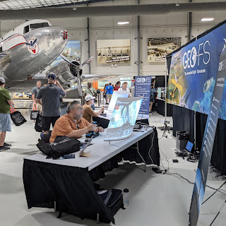
The booth next to my favorite aircraft (Douglas DC-3)
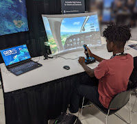
The general first reaction is to wonder what simulator this is: these events tend to be saturated with the few big players in the market and people are surprised by new software that is unknown to them.

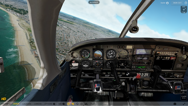
Visitors are usually impressed with the result and performance that comes out of a web browser based simulator. 

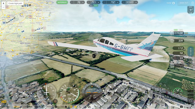
Then they grab the stick and start to appreciate the accuracy of the flight model, the quality of the environment and the rich collection of 30+ available aircraft. 

Finally, they really are baffled by the fact that the whole world is available to fly in, with multiplayer, radio navigation, real time weather, etc.

Now, I was the one surprised by the number of visitors telling me they knew and have been flying GeoFS at some point. Some for years, other have moved on to more sophisticated sims but most keep good memories of it and this is really gratifying.

Everybody quickly understands where GeoFS fills in a gap in the software offering for an easy to access and simple to understand alternative to the bigger platforms while maintaining a satisfying experience in terms of rendering and handling.

Some of the feedback also confirmed the trend of interest from education professionals. Several teachers, who attended, really liked the idea of having an easy to deploy and simple to operate, web based flight simulator they could use to bring an introduction to aviation to their students. I could share with them the feedback already gathered from other schools and from Aerobility's experience when it comes to training using GeoFS. I also put forward the newly deployed GeoFS PRO platform that brings a dedicated infrastructure and extra features such as controls sharing to GeoFS institutional users.

Across these hectic two days and among many interesting and interested attendees, the GeoFS booth received the visits of a YouTube celebrity whose name ends in 001, a few GeoFS fans and event organizers, a duo of representatives from the biggest flight simulator software around, an enthusiastic French speaking Vietnamese from SoCal, a retired 737 pilot, a sea plane pilot, a hot air balloon pilot, some friendly competitors, a Twitch streamer in red shirt disguise whose name starts with Sky, a book writer, some lost tourists and a few cadets from the Lone Star Squadron.

After wrapping up the show and the booth and paying an obligatory visit to the Space Center Houston, I flew an uneventful flight without any bomber encounter back to Europe.

I want to thank the FSA/FSExpo team for the excellent organization. They did a great job and surpassed all the previous editions in terms of attendance. The seminars and presentations are now available online at flightsimexpo.com

I also want to thank the FSElite team for featuring GeoFS in a brilliant 4 pages interview in the fourth issue of their magazine, especially edited for the event.

Can't wait for next year's edition!


Friday, April 28, 2023

Aerobility VAE Cursus With GeoFS

A few months ago, Aerobility, a UK based charity contacted me to see if GeoFS could be used in their new Virtual Aviation Experience (VAE) program. Aerobility is dedicated to teaching flight to disabled people with the help of custom equipped aircraft and facilities. The pandemic and the ambition to reach a wider audience got them thinking about remote teaching and they needed a tool for that. The fact that GeoFS is web based makes it a very good fit: you can just share a link with the students and they start flying right way! Moreover, GeoFS's control sharing feature enables the instructor and the trainee to fly the same plane each from their own computer and swap control at will. However, making sure people with severe disabilities can use the simulator easily was the real test for an application that calls itself "The Accessible Flight Simulator".

A few discussions and experiments later and I was building the Piper PA-28 used for Aerobility's real world training, down to the exact cockpit layout reproduced from pictures, and wrapping it in their own livery. Getting used to reading instruments and manipulating controls in a cockpit that shows the proper layout is a great plus for young pilots who will soon find themselves in the real plane. Flying VFR with high resolution aerial images also prepares the students to recognise the area and get familiar with landmarks around the airport.

The simulated aircraft was tested by Mike Owen, Aerobility Chief Flight Instructor, who provided feedback on the plane's behaviour compared to the real thing. The goal is to be able to replicate maneuvers done in real-life conditions and see the same reaction from control input.

In February, Mark Rothwell, VAE Program Manager and Mike Miller-Smith, Aerobility CEO, were kind enough to invite me to their home base at Blackbushe Airport (EGLK), an hour drive south-west of London, to visit their facilities and see first hand what it takes to fly with disabilities. Mike made me fly GeoFS using a clever gyro-based controller device you wear like pair of glasses - a way to "eat my own dog food" as we say in the software industry.

I could really feel the passion and enthusiasm for aviation of the whole Aerobility team. Mark has plenty of experience when it comes to flying and has the patience to bear with my tinkering with GeoFS to make it work for them. Mike has a vision and the drive , and it is truly impressive to see him flying the sim using eye tracking and voice control (Mike suffers from muscular dystrophy). I was sitting next to him during a - rather acrobatic - session in GeoFS' Piper Cub and I could instantly spot all sorts of limitations in the application when it came to accessibility. I made some modifications to the user interface, controls and settings as soon as I got back to my keyboard to alleviate some of these pain points. But I am sure much more can still be done as I will gather more feedback from Aerobility trainees and instructors.

I also got the chance to try the PA-28, first hand, during a quick flight over the British countryside together with Mike. Mike is a brilliant instructor and had me go through some flaps/rudder/stall maneuvers to see and feel how the aircraft behaved. I used this great opportunity to take note of some of the specifics of the aircraft and fine tune the flight model once back at home.

This was, overall, a very rich and fulfilling experience. I am very proud and very happy to see GeoFS being used in such a way.

The Aerobility VAE cursus is just getting started and all info and registration can be found here: https://www.aerobility.com/virtual-aviation-experience


Friday, January 20, 2023

GeoFS 3.5 - The World in 3D

Ever since the migration from Google Earth to Cesium, buildings have been dearly missed in GeoFS and this was one of the most requested features. Starting this year with version 3.5, the GeoFS world is now populated with over 500 million buildings generated from OpenStreetMap data. Oh, and a couple billion trees have been planted too, just to add a bit of green.


Buildings (and trees) in GeoFS are still experimental features and need to be enabled in the Option > Graphics settings panel.

What sort of coverage/quality can be expected?

The coverage is worldwide but OSM data can be missing in some areas. 

OSM provides building footprints along with (but not always) some metadata such as height, type, period, roof shape, color, etc. When this data is missing, it has to be guessed or randomized. Big cities like New York or Paris have pretty accurate building definitions whereas suburban or rural areas only provide basic land survey data. 

GeoFS buildings are generated using in-house tools that may (or may not) do a correct job at estimating and extrapolating missing data and adding height, roofs and textures based on what can be guessed from the metadata. Theses tools are being improved and tweaked and some new data will be regularly pushed to the servers. 

And of course, all this has to be easily maintainable, served fast and run at a reasonable frame rate in your browser. A single texture is being used for global buildings which will fall short of variety and have a bit of a generic look to it whether you fly in America, Africa, Europe or Asia. But this has the advantage of being cacheable and much easier to generate, maintain and update!

The 3D models are also heavily compressed which will sometimes lead to some imprecision in building shapes.

Finally, some major landmarks, despite the most creative attempt made by OSM contributors, will never look quite right when extruded from a 2D shape. This is why some of them have been replaced by proper 3D models. i.e Statue of Liberty, Eiffel Tower, Christ the Redeemer, London Eye, etc.

How about Airports?

For certain airports, OSM does provide gates location at which a generic Jetway model will be positioned (orientation is difficult to guess and can be off). Some will only show blocky terminal or gates. Wherever available, detailed airport 3D models have been placed instead of OSM generated ones (Amsterdam Schiphol, Paris Charles de Gaule, San Francisco, Madrid, London Gatwick, Nice and Stockholm Arlanda). More may be added depending on availability.

Is it possible to land (crash...) on the buildings?

No, appart for some specific landmarks (aircraft carrier, Golden Gate Bridge) there is no collision detection with 3D buildings for now. This is something that will be worked on. There is no definite date though.

How to contribute to or fix the data?

OpenStreetMap is a participative application and accept contributions from anyone. However, the process can be complicated and the expected quality standards do require a certain amount of experience with GIS data.

Changes to OSM data will not be reflected right away in GeoFS. Given the current infrastructure being used, it takes about a week and a half to download, import and process a fresh global dataset. There will most likely be several updates a year depending on the evolution of the source data and the improvements made to the generator tool. 

And there are so many other things that need to be worked on...


Thursday, August 18, 2022

GeoFS 3

After about one year of public beta testing, GeoFS 3.3 has gone in full production. To make sure every one can enjoy GeoFS while the last issues are being ironed out, the old 2.9 version is still available at https://legacy.geo-fs.com/geofs.php

The new version is bringing major changes to GeoFS among which:
- More realistic atmosphere light scattering
- New water rendering including wind dependent waves and surf
- Water physics for ditching and float planes (and a DHC-2 to go with!)
- Volumetric clouds with live cloud coverage (based on infra-red satellite images)
- Improved terrain lighting
- Texture rendered glass panels (PFD, HUD, G1000)
- Transparent gauge overlays and instruments re-ordering
- Experimental foliage rendering with global ground usage classification
- Global radio navigation VOR, NDB, DME, ILS
- Various navigation instruments fitted to matching aircraft (ADF, RMI, CDI, HSI, ILS)
- New runway database
- The Golden Gate Bridge!

Thursday, June 10, 2021

GeoFS Backs VFREnglish.com Online Radiotelephony Courses


The flying school VFREnglish.com has started offering online VFR radiotelephony courses. Both founders are experienced and certified pilots and instructors who took up the mission to help pilots improve their skills and confidence when communicating in the air. They have chosen GeoFS to support their online courses and make their students practice real flying situations while communicating. The web based nature of GeoFS made it easy and natural to integrate to VFREnglish online platform where students are just one click away from any flying location and conditions. Enhanced with GeoFS HD imagery and extended with an online audio chat, VFREnglish students can fly accurate VFR exercises together, under the monitoring of their instructors who can track their flight on the ATC map.


VFREnglish currently offers three different courses from "Basic" to "Pro" that will all provide students with one year of GeoFS HD and can lead, in the "Pro" plan, to preparing for the ICAO exams.

Visit the VFREnglish.com website to get more information or read their testimonial on using GeoFS professionally.


Tuesday, March 2, 2021

GeoFS 2.9


It has been one year since the last update on the GeoFS blog. So it probably is due time to increase the version number by another notch. GeoFS is undergoing continuous development and updates so there is no tangible release cycle, but for celebration purpose, let's just blow another candle and list all the events of this year 2020:

  • Covid-19: yes, it has also impacted GeoFS, as it impacted everyone's life this year. Development had to slow down a bit but things are improving and there is light at the end of the tunnel.
  • Water detection and rendering
  • Carrier arresting cables
  • Improved wind/terrain interaction, improved turbulences, added thermals
  • Fixed fog problems and weather engine performance
  • New Pilatus PC-7
  • Reworked Concorde exterior and cockpit
  • Reworked Su-35 exterior and cockpit
  • Reworked “Major Tom” hot air balloon with multi-liveries
  • Refreshed airport and runway data
  • GeoFS for Schools licensing: bringing GeoFS to the classroom.
  • GeoFS Light app: free, self contained version of GeoFS for Android and iOS
  • Loads of Community Contributed aircraft: thank you to all the developers!
  • And... the general bug fixes and performance improvements

Wednesday, February 12, 2020

GeoFS 2.8


GeoFS version has been incremented one notch to validate the following new features and content:

- Contrails (also for multiplayer and ADS-B)
- Wing flex (A380, 737, DC3, Silent 2)
- Multiple livery support
- Translating camera and new fixed mode
- Improved replay with all animated part
- Vertical speed control for autopilot
- Reworked A380
- Reworked Piper Cub
- Eurocopter EC135
- Alisport Silent 2 Electro motor glider
- Advanced graphics configuration
- Transparent UI and redesigned website